- 1. Blackrock Summit
- 2. Bearfence Mountain Trail
- 3. Compton Peak Summit
- 4. Hawksbill Loop
- 5. Mill Prong Trail to Rapidan Camp
- 6. Gap Creek Trail to Duncan Knob
- 7. Sky Meadows Loop
- 8. Riprap Trail
- 9. Signal Knob Loop
- 10. Three Ridges
- 11. What to Bring for Your Shenandoah Valley Hiking Trip?
- 12. Blackrock (1 mile)
- 13. Bearfence (1.2 miles)
- 14. Compton Peak (2.2 miles)
- 15. Hawksbill Summit (2.8 miles)
- 16. Duncan Knob (3.5 miles)
- 17. Big Schloss (4.1 miles) & Tibbet Knob (3.1 miles)
- 18. Sky Meadows Summit (6 miles)
- 19. Riprap (9.8 miles)
- 20. Signal Knob (10.2 miles)
- 21. Three Ridges (13.2 miles)

The 10 Best Hikes in Virginia's Shenandoah Valley (2022)
11 min read
Table of Contents [Show]
The Shenandoah Valley, part of the Great Appalachian Valley, starts at the top of Virginia and is cradled by the Blue Ridge and Allegheny Mountains. Within the 140-mile valley lie stunning hiking trails that will lead you through oak forests and up to inspiring heights with sublime views. Whether you’d like to take a leisurely stroll to gorgeous vistas, scramble upon giant boulders or pack a bag for a multi-day hike that will recharge your whole system, there are routes for everyone to enjoy. Whatever you’re into, the historic Shenandoah Valley offers admirable trails for all. To get you started on your adventure, here’s a list of the10 best hikes you’ll find in this section of Northern Virginia:
1. Blackrock Summit
Length: 1.1 miles
Elevation gain: 180 ft.
Difficulty: Easy
Dog friendly: Yes, kept on a leash
Location: Grottoes, VA
Blackrock Summit via Trayfoot Mountain and Appalachian Trail is a rather easy hike that is perfect for anyone who’s looking for exceptional views of Shenandoah Valley and Massanutten Mountain. This is a great trail for bird watchers, families, dogs or anyone looking for gorgeous scenery without having to go too far into the wilderness. The trailhead can be found on Skyline Drive, between mileposts 84 and 85.
2. Bearfence Mountain Trail

Length: 1 mile
Elevation gain: 242 ft.
Difficulty: Moderate
Dog friendly: No
Location: Elkton, VA
Bearfence Mountain Trail may be a short 1-mile hike, but it’s not exactly beginner-friendly. A portion of this hike quickly turns into an obstacle course with a scramble climb over large boulders. This is a fun opportunity if you’re willing to navigate with your hands and feet in order to rise to the summit for an amazing 360-degree view of the valley below. It should be noted that near the summit the trail passes incredibly close to the edge of sheer drops, so this may not be a hike for those who have trouble with heights. The trailhead is located between mileposts 56 and 57 along Skyline Drive.
3. Compton Peak Summit
Length: 2.3 miles
Elevation gain: 705 ft.
Difficulty: Moderate
Dog friendly: Yes, kept on a leash
Location: Chester Gap, VA
Compton Peak Summit is a great trail for all ages and can be accessed via the Appalachian Trail. You’ll climb less than a mile from the trailhead to where you’ll be met with an intersection. Turn right to reach an overlook with awe-inspiring views. Turn left to observe a unique rock formation known as columnar jointing. This geological feature is a mosaic of basalt formed by lava flows from millions of years ago. The hexagonal joints resemble that of a honeycomb and are a must-see sight. The trailhead is located along Skyline Drive between mileposts 10 and 11.
4. Hawksbill Loop
Length: 2.7 miles
Elevation gain: 748 ft.
Difficulty: Moderate
Dog friendly: Yes
Location: Mauck, VA
The Hawksbill Loop trail is an easy to moderate hike that will lead you to the highest peak in Shenandoah. You can access this trail using the Appalachian Trail system, a white-blazed marked trail that will lead you to Hawksbill summit overlooking the Blue Ridge Mountains. There are many picturesque waterfalls, native wildflowers, and songbirds that make this a gorgeous trail to hike. The trailhead is located at Hawksbill Gap parking lot on Skyline Drive between mileposts 45 and 46.
5. Mill Prong Trail to Rapidan Camp
Length: 3.7 miles
Elevation gain: 731 ft.
Difficulty: Moderate
Dog friendly: Yes, kept on a leash
Location: Syria, VA
Mill Prong to Rapidan Camp is a picturesque hike that leads you through moss-covered trees, across rolling streams, and then to a calming waterfall. This is a great day hike or you could bring a tent and check out some of the pristine campgrounds in the area. The trailhead can be found at the Milam Gap Parking lot off of Skyline Drive. Take the Appalachian Trail a few feet until you see the blue-blazed Mill Prong Trail.
6. Gap Creek Trail to Duncan Knob

Length: 3.3 miles
Elevation gain: 1,040 ft.
Difficulty: Moderate
Dog friendly: Yes, except the top portion
Location: Luray, VA
Gap Creek Trail can be found within the George Washington National Forest. The hike begins at the Gap Creek trailhead and steadily climbs up to Duncan Knob where you’ll arrive at a jaw-dropping boulder field. Here you can scramble your way to the summit for a beautiful 5-star view of the entire valley. Be aware that this entire trail is incredibly rocky, so watch your step as you hike your way to the top.
7. Sky Meadows Loop

Length: 6.8 miles
Elevation gain: 1,322 ft.
Difficulty: Moderate
Dog friendly: Yes, kept on a leash
Location: Delaplane, VA
Sky Meadows Loop is the perfect trail for anybody looking for a tranquil hike among a vibrant green forest with wide-open meadows. The Sky Meadows State Park has a plethora of trails varying in length, but a good option is to start with the loop. Then you’ll be able to string other trails together for a full-spectrum experience. This is a moderate rated hike that is great for the whole family!
8. Riprap Trail
Length: 9.3 miles
Elevation gain: 2,116 ft.
Difficulty: Hard
Dog friendly: Yes, kept on a leash
Location: Grottoes, VA
If you’re looking for a full day in the woods then the Riprap trail would be an ideal path to hike. This loop strings together the Appalachian, Riprap, and Wildcat Ridge trails for a beautiful, yet strenuous, trip. Along the path are multiple streams you’ll have to cross, so be prepared to get your feet wet. There are also tremendous views from Calvary Rock and Chimney Rock before it drops down into a small gorge Here you’ll encounter waterfalls accompanied by a deep swimming hole. The trailhead is accessible from the Riprap parking lot, just past milepost 90 on Skyline Drive.
9. Signal Knob Loop
Length: 10 miles
Elevation gain: 2,217 ft.
Difficulty: Hard
Dog friendly: Yes, kept on a leash
Location: Fort Valley, VA
Signal Knob Loop is a challenging hike with a lot of elevation gain over a very rocky path. This is a great trail for anybody looking for a long journey inside George Washington National Park. The views are excellent, the creeks are flowing gently and the path is long; perfect for a peaceful full day in nature. This is a full loop trail that can be taken either way, though the clockwise route will end with a nice, gentle, downhill route.
10. Three Ridges
Length: 13.3 miles
Elevation gain: 3,917 ft.
Difficulty: Hard
Dog friendly: Yes, kept on a leash
Location: Roseland, VA
Amazing vistas, many small waterfalls with swimming holes, campgrounds galore, and birdwatching are just a few key attractions to this extensive trail. Three Ridges is an epic and arduous hike that is meant for those who have experience with long treks in the forest. This trail is meant to take more than one day, so if you’re up for the challenge, bring a pack full of all the necessities and enjoy!
What to Bring for Your Shenandoah Valley Hiking Trip?
The forests are incredibly inviting, asking us to discover the peace from within, but they are also unpredictable. Sometimes we may get distracted from the path we’re on and take a walk into unknown territory, or the weather may change in an instant. So it’s a great idea to be prepared with a few key items, especially on long, multiple-day hikes. Here is a list of essentials you may need:
- Water bottles or camelback for long hikes
- Water filtration (lifestraw)
- A map in a protective case
- Protein bars
- Rain jacket
- Compass or GPS
- Binoculars
- Sunglasses
- Headlamp or flashlight
- Matches or lighter
- Knife or multitool
- Small first-aid kit
- Whistle
- Insulated jacket
- Proper hiking boots
- Bag for used toilet paper
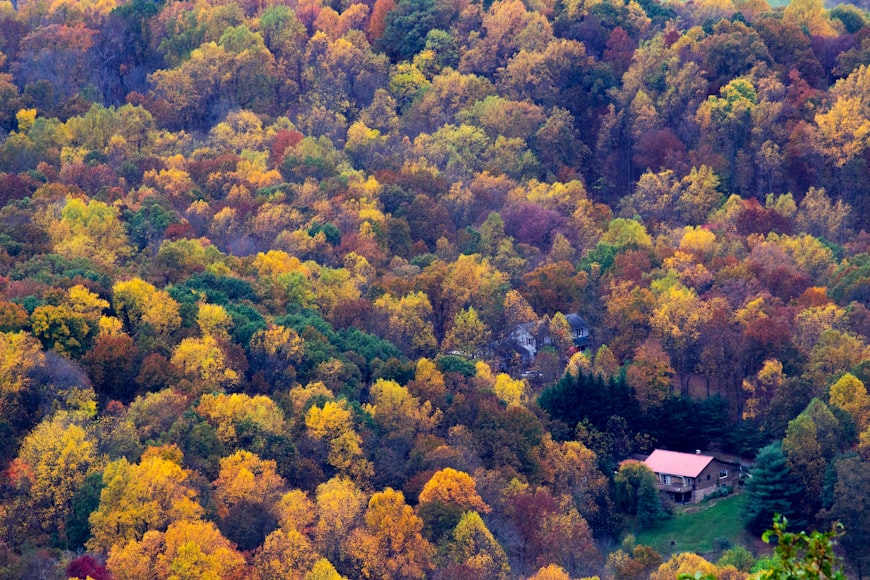
If you travel to the Shenandoah Valley and hike its trails, you may find exactly what you’re looking for. The area offers amazing scenery that could be described as a photographer's dream. One of the best times to visit the park is in early fall when the leaves are glowing in shades of yellow, orange, and red. Remember to check the weather forecast before your hike, as rain will make a rather challenging trek over slippery rocks. Also, be sure you know your limits and don’t try to tackle a 10-mile trail without being prepared. Most of all, enjoy your time, enjoy the views, and enjoy the natural surroundings of the Shenandoah Valley!
Featured image provided by Robert Aberegg
It’s not easy to pick a favorite hike among the myriad options in the Shenandoah Valley. But when I want to go on a hike, these 10 are the ones I turn to over and over again. They’ll challenge you in a number of ways, bring you to unique features and stunning views, and leave you with memories that you’re eager to share and repeat. I can’t wait to hike them all again.
Blackrock (1 mile)
Clocking in at just one mile, there’s no excuse for not being able to squeeze in this hike. A relatively easy walk along the Appalachian Trail will bring you to one of the most striking features in Shenandoah National Park—Blackrock, an impressive talus slope with boulders aplenty to scramble up for even better views. The trailhead is located between mileposts 84 and 85 along Skyline Drive.
Bearfence (1.2 miles)
Bearfence may be short, but it is mighty—and a lot of fun. Famous for its rock scramble, you’ll find yourself using your hands and feet to pull yourself up and over each obstacle, all while taking time to enjoy the nearly 360 degree views of the area. You can find the trailhead between mileposts 56 and 57 along Skyline Drive.
Compton Peak (2.2 miles)
Want some geology with your views? The hike to Compton Peak will deliver both. Follow the Appalachian Trail from the parking area, located along Skyline Drive between mileposts 10 and 11. You’ll climb less than a mile and arrive at an intersection. Turn right for westerly views and left, to the east, for geology. The eastern trail leads you to a rock outcropping that is made of columnar basalt. Descend a bit to marvel at the unique shape of the rock.
Hawksbill Summit (2.8 miles)
Explore Shenandoah’s highest peak with this outing. You can access the trail from Skyline Drive at the Hawksbill Gap Parking Area, located between mileposts 45 and 46. Follow the blue blazes for the Lower Hawksbill Trail, and start climbing. A day-use shelter, Byrd’s Nest, yields good views at the top but the better ones are to be had at the viewing platform. Even better than the views: Your way back to the car is all downhill.
Duncan Knob (3.5 miles)
When the crowds are at Old Rag, you can have a rock scramble and vistas to yourself at Duncan Knob in the George Washington National Forest. The hike starts from the Gap Creek trailhead with an easy-enough-climb until you reach the turn to Duncan Knob and arrive at a jaw-dropping boulder field. Scramble up to the summit and find a good spot to check out views of Massanutten Mountain, the Blue Ridge Mountains, and Shenandoah Valley.
Big Schloss (4.1 miles) & Tibbet Knob (3.1 miles)

Either choice is an excellent one. Sister hikes Big Schloss and Tibbet Knob are both accessible from the Wolf Gap Recreation Area. Big Schloss is a bit longer and more popular, but the rock outcropping—named by German immigrants, it means castle—is a sight worth seeing. Tibbet Knob is shorter, but has two rock scrambles to make your hike to the vista an interesting one. Bring snacks. You’ll want to linger at the top for both.
Sky Meadows Summit (6 miles)
Sky Meadows State Park is unique among Shenandoah locations, giving you views of the graceful Piedmont region. You can string together various trails in the park to craft hikes of varying lengths. A good option is to take the South Ridge Trail to the North Ridge Trail, and then onto the Appalachian Trail. The Ambassador Whitehouse Trail will lead you back to the North Ridge Trail, but consider the detour onto the Piedmont Overlook Trail for a view of the historic Mount Bleak House as you make your way down.
Riprap (9.8 miles)
How about a swimming hole? This loop strings together the Appalachian Trail, Riprap Trail, and Wildcat Ridge Trail for an excellent—but tough—day in the park. You’ll get great views from Calvary Rocks and Chimney Rock before dropping down into a small gorge, where you can marvel at waterfalls and arrive at a deep swimming hole. Enjoy your time here, you’ll have to climb back up to the ridge to complete your hike. The trailhead is accessible from the RipRap Parking Area, just past milepost 90 on Skyline Drive.
Signal Knob (10.2 miles)
Full disclosure: Signal Knob in the George Washington National Forest is one of my favorite hikes. Is it the view from Signal Knob? The challenging climb? I can’t point to one reason, but I’ll go there in a heartbeat. Most hike it counterclockwise, but I believe clockwise is the better way: you start with a climb from the parking area along 678/Fort Valley Road, get great views and a good lunch spot in the middle at Signal Knob, and end with a (mostly) downhill route that yields even more good views. It’s a great hike for those looking to transition to longer miles.
Three Ridges (13.2 miles)
Now this is an epic hike. From the parking area on Route 56, it starts off with a five mile climb and rewards you with a few more climbs after that one. But those views are spectacular ones, and you’ll find yourself lingering to get just one more glimpse at the valley below. Most of the hike is along the Appalachian Trail, with a detour along the blue-blazed Mau-Har Trail to complete the loop.
Written by Jen Adach for RootsRated in partnership with Staunton and legally licensed through the Matcha publisher network. Please direct all licensing questions to [email protected].